


26 Maps of the World
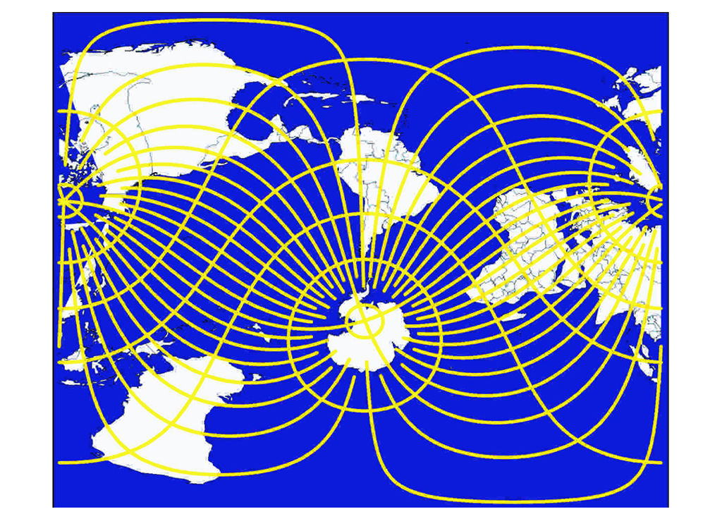
The map of the world that we have in our head is the result of our economic and political history. The vast majority of all world maps are ‘cylindrical projections,’ such as Mercator, Gall and Miller. As a result, on most world maps, Europe is on ‘the right side of the middle’ and the USA is positioned on the upper left side. The North Pole can hardly be seen, whereas the South Pole is mostly left out completely or looks like yoghurt in a bowl. On the East and West side are two political opponents: USA and Russia. The vertical centre line, called the ‘Prime meridian’ goes through London. (On Asian maps the centreline is often shifted).
Mapmakers, who predominantly came from the western world, have told us what ‘the relevant parts’ of our world are and which cities are worth mentioning. On a world map New York will never be left out, but ‘unknown’ metropolis like Lahore or Dongguan will. They are obviously less important.
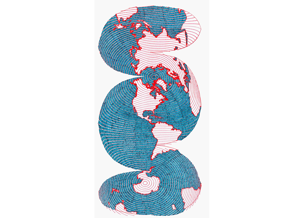
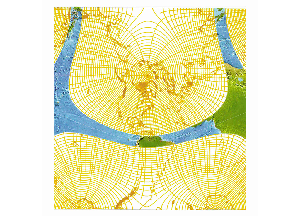
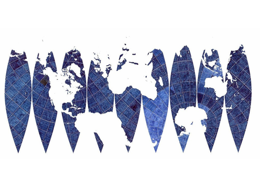
True, precise and correct maps
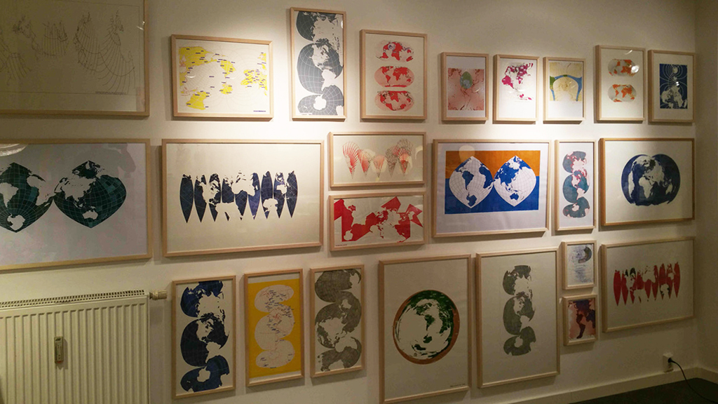
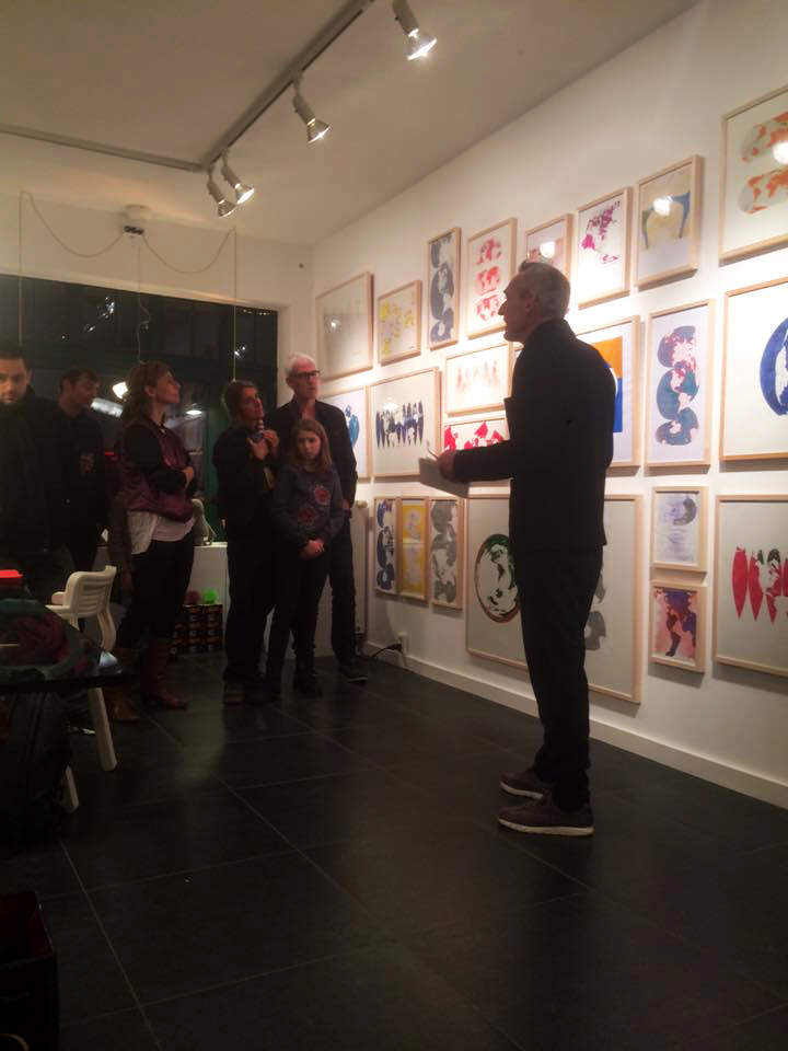
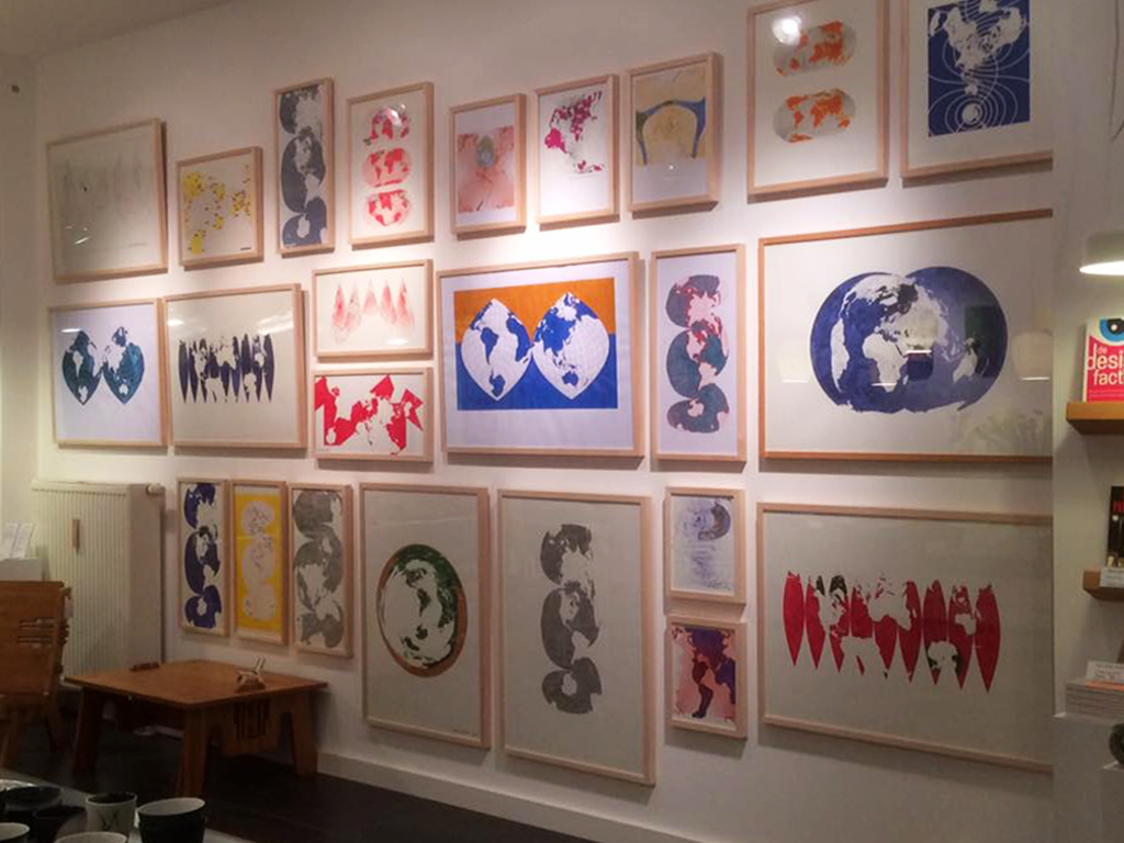
Lucas Verweij is a cartographer who concentrates solely on world-maps. He projects untraditional maps of our planet. Although his maps often appear strange, they are all true, precise and correct. All of the maps shown here are just as valid as regular world maps, they carry the same amount of distortion. All maps are digitally conceived, but many of them are hand drawn or hand coloured. Some are drawn with fountain pen, pencils, pen plotters or printed as lithography.
Until recently, physical maps were indispensable tools, especially at times of war. But in a digital age we don’t need them printed. Maps are slowly being reduced to data clouds without a physical dimension. These maps embrace the cultural dimension that maps have as well.
“What If?”
These maps are made with other assumptions, like ‘what if the South Pole was inhabited by humans? ´ Or ‘what does a map look like when only the unimportant places have names? ’ ‘Can we make a map of the world where one country spans the whole world?‘ And ‘What if confluence points were to form capitals?’ These maps show that there are infinite ways to project the world and every different one has different social and political implications.
About the artist
Lucas Verweij studied design in Eindhoven. He began making maps after his graduation. He made maps of the ‘Randstad’, showing the Dutch urbanised region as a true metropolis and he was involved in making ‘the new map of the Netherlands.’ His interest in world maps goes back to 1999, when he made the film ‘Mercators blindspot.’
Verweij’s mapping works have been on display in de Appel, Amsterdam, Manifesta Lublijana, Ps1- New York, Stroom, den Haag, Henri Moore Foundation, Leeds and the Architecture Institute, Rotterdam. Verweij also works as a design critic and teacher.
More Lucas Verweij > 14.10.2016